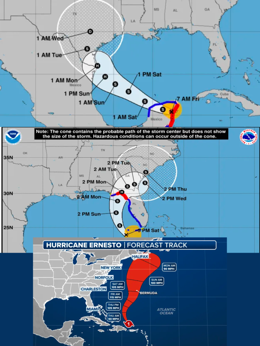
Hurricane Beryl, tropical storm Debby, and now tropical storm Ernesto have brought torrential downfall and damage to the Southern and Eastern Coasts of North America. This could be the start of a heightened hurricane season.
Hurricane Beryl formed on the coast of Africa as a low level tropical depression on June 25. By June 29, it was categorized as a hurricane. The very next day, it became the earliest category four hurricane the Atlantic Ocean had ever seen.
By July 1, many of the islands in the Caribbean sea were impacted by the storm, causing extreme damage. According to Convoy of Hope, more than 90% of all buildings on the islands were either damaged or completely destroyed. The hurricane claimed 11 lives in the Caribbean before making landfall in the Gulf of Mexico as a category two hurricane on July 5.
Landfall in the US happened on July 8 as a category one storm. It downgraded to a tropical storm a few hours after making landfall, but not before producing $2.5 billion in damages, including extensive flooding and damages to power lines, leaving nearly 3 million Texans without power for weeks.
Storms surged throughout Texas for days on end. The path of the storm continued upward after landfall, curving slightly to the right as residents in southern Michigan and northwestern Ohio felt the effects of the storm. Tornadoes were reported as far northeast as New York and as far northwest as Montana. Texas and Arkansas were ravaged by tornado damage and winds as high as 81 miles per hour. One tornado was also reported in southwestern Indiana.
Tropical storm Debby, the most recent of tropical storms, was spotted off nearly 200 miles southwest of Tampa, Florida, on August 4. Early on the 5, Debby hit Florida as a category one hurricane and spent nearly an entire week ravaging the east coast before moving into Canada the following weekend. In Florida alone, damages are expected to total hundreds of millions of dollars, as there was extensive damage to power lines and massive amounts of flash flooding in the area.
The storm moved out of Florida after causing extensive damage late on the 6th, moving north into Georgia and towards South Carolina. Georgia and South Carolina were projected to have the most rain, however the most seen in each state was 13 and 17 inches respectively. The most rainfall was seen in Lake City, Florida, at 19.67 inches.
Damage-wise, Georgia and South Carolina experienced the worst of it. There was an extensive amount of damage done to streets, houses and other structures, cars, and power lines across each state, estimating over $28 billion in economic losses. By the time of Debby’s departure from land, moving back over the Atlantic Ocean, South Carolina saw as much as 25 inches of rainfall, causing extreme flash flooding according to The Weather Channel. Cars and many houses have been lost due to flood damage. Debby continued to affect both states from the 6th to the 8th, before moving upward through North Carolina.
Other states affected by Debby’s arrival didn’t see nearly as much damage nor as much rain. The most rain recorded in North Carolina was just over 9 inches at most with a little bit of flash flooding. Storms continued up the east coast before reaching Canada later that weekend, according to ABC News.
Now, a new hurricane named Ernesto has hit Puerto Rico. Late on the 14th, tropical storm Ernesto hit the island hard, leaving nearly quarter of a million people without power across the country. According to USA Today, the storm traveled northwest towards Bermuda. The storm could strengthen to a category 3 hurricane by the 18th, before approaching Bermuda the following day. By the 20th, Ernesto was estimated to continue drifting northwest over the Atlantic Ocean, and possibly having hit St. Johns, NL in Canada.


